Level of difficulty: Easy
Distance travel: 15.1 km.
Maximum altitude: 519 m.
Estimated time: 4 h 10 min
Departure site: Tourist Office / Sa Riera park

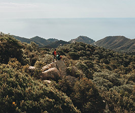
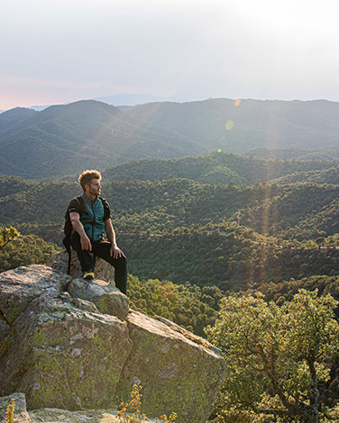
Circular itinerary going around Montllor Mountains and up to Puig de ses Cadiretes (519 m), the highest peak in the Ardenya Cadiretes Massif. From the summit there is an impressive panoramic view of the area, including the large Mediterranean-type forest. The whole itinerary is along tracks in a perfect state of repair, except for a short stretch of path leading to the summit, including a final rocky stretch where extreme caution is advised. The gradient is considerable.

St Grau path
Level of difficulty: Low
Distance travel: 15.2 km.
Maximum altitude: 400 m.
Estimated time: 4 h (2 h 15 min going and 1 h 45 min. coming back).
Departure site: Tourist Office / Sa Riera park

The itinerary goes through Mediterranean-type woods with dense, compact vegetation (mainly cork oak groves but also some pines and holm oaks), passes by the ruined hermitage of Mare de Déu de Gràcia, and on to the sanctuary of Sant Grau in the heart of the Ardenya Cadiretes Massif. The sanctuary has a major historical legacy of legends and tradition.

Ruixons path
Level of difficulty: Low
Distance travel: 11 km.
Maximum altitude: 303 m.
Estimated time: 3 h
Departure site: Tourist Office / Sa Riera park

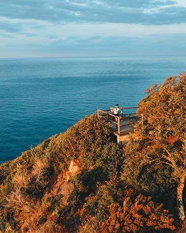
Itinerary leading to Ruixons torrents, among the many typically Mediterranean torrents carving through the depressions of the Ardenya Cadiretes Massif. Natural sources abound in this territory, giving rise to springs of untreated natural water flowing practically throughout the year. The route also affords magnificent views of the coastline to the north of Tossa.

Megalithic path
Level of difficulty: Easy
Distance travel: 10.50 km.
Maximum altitude: 480 m.
Estimated time: 3 h
Departure site: The sanctuary of Sant Grau
This circular itinerary leads us to discover the heights that surround the summits of Montagut and Cadiretes, starting from Sant Grau’s Sanctuary, passing through a good ridge between the megalithic monuments preserved in the prolific area, including the crown’s jewel (the top one) of the route, the Stone-over-the-other (“Pedra-sobre-altra”).
This route hasn’t been marked yet, so we recommend you to use the Natura Local App, where you will find the necessary indications.